After saying goodbye to my friend Taylor, I traveled further North - first to Tromsø (the largest city in northern Norway) and then to Alta. Alta is located at 70 degrees North latitude. For comparison, in North America 70 degrees North runs along the northern coast of Alaska.
It was the beginning of August, and it was still light outside for nearly 24 hours. Around 11pm the sun would begin to set. It would eventually touch the horizon and hover there for a bit before rising again by 2am. Sunset blended into sunrise and there was no semblance of night.
I made the trip to Alta to visit a unique hytte with an interesting history,
Nordlysobservatoriet Haldde (translation: the Northern Lights Observatory at Haldde). The hike to get there took me to the highest point in the region, the top of a mountain called Sugartop. En route, I was fortunate to stumble upon a herd of reindeer!
 |
| reindeer! |
 |
| You can actually see the hytte when you are a couple miles away - notice the oddly squarish object on top of the tallest mountain on the horizon (and the path leading all the way there) |
Nordlysobservatoriet Haldde
Nordlysobservatoriet Haldde is a place steeped in history. It is the subject of many books. A brief summary -
The observatory was constructed in the year 1899 under the direction of Professor Kristian Birkeland as a place to observe and study the northern lights. It was the fist permanent structure built for this purpose in the entire world. Birkeland spent winters at the observatory in a humble living quarters on the first floor (this far north, during the winter there are ~24 hours of darkness for an extended stretch, yielding excellent opportunities to see the northern lights). To accommodate growing research interests and the involvement of more people, a second building was constructed in 1912 that included apartments, offices, and space to store scientific instruments. At its height, three families with children lived at Haldde. A 9 km carriage road was constructed up to the facility and there was even a cable car line for use during the winter! The facility at Haldde was continuously operated until 1926, when the research efforts were moved to Tromsø. In 1944, during World War II, German forces burned down nearly everything at Haldde (and in this entire region of Norway actually) leaving only the solid stone walls standing. The buildings were restored during the 1980s due to their historical significance. Since 2017, the observatory has operated as a no-service DNT hytte with 6 beds for overnight accommodations. The larger residence is still being restored and remains locked except during special events.
 |
| Nordlysobservatoriet Haldde with bust of Kristian Birkeland guarding the entry |
 |
| a photo of the observatory from 1899 - hasn't changed much! |
With such a fascinating history, staying the night at Nordlysobservatoriet Haldde was a pretty surreal experience. It's interesting that instead of turning the observatory into a museum or something similar, the choice was made to convert it into a DNT hytte. It's a pretty humble place even for hytte standards. There are basically three rooms - a long room with beds on one end and the kitchen and dining space on the other, a small mud room for storing boots and coats upon entry (and snow shoes and skis) which has stairs up to the third "room," a viewing platform on the roof from which to observe the northern lights. Sadly, being there during the summer, I had no chance of seeing the northern lights. They actually still occur during the day, but without the backdrop of darkness, they are invisible.
 |
| the "sleeping end" of the long room |
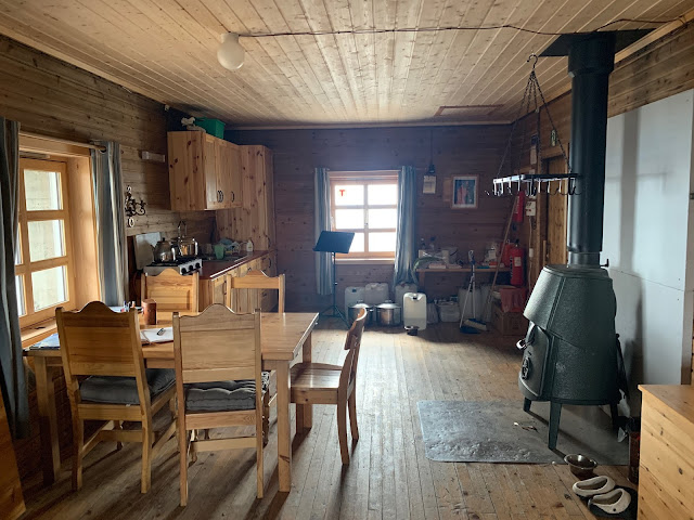 |
| the "cooking/dining/sitting end" of the long room |
 |
| stairs from the mud room up to the viewing platform |
 |
| the (very heavy) roof hatch |
 |
| looking north from the viewing platform towards the city of Alta and the Altafjord |
 |
| looking south from the viewing platform |
The observatory itself is of very sturdy construction - built to withstand high winds and brutal winter weather. The stacked stone walls that form the enclosure are around two and a half feet thick. The main room has three small windows that are mounted on the inside face of the wall. This means when you look out the window, you are keenly aware of the heft of the exterior walls - which adds to the feeling of shelter and separation from the outside. The wood cladding on the interior was added during the restoration work in the 80s. I'm not sure what the interior looked like originally.
 |
| looking out the window through the thick stone walls |
The use of stacked stone as the primary construction material has both practical and aesthetic functions. The observatory is located at about 3000 feet above sea level - far above the tree line in the area. Building out of the readily available stone was probably much easier than hauling lumber up to the mountain top. A quick look at the surrounding terrain reveals that the stones were collected in the immediate proximity. By literally using the ground below to construct the building, it becomes an extension of the earth. This is emphasized by its position at the highest point of the mountain - although it is clearly manmade, the observatory takes on the role of Sugartop's new peak.
 |
| the observatory is located right at Sugartop's highest point |
 |
| the front door and bust of Professor Kristian Birkeland |
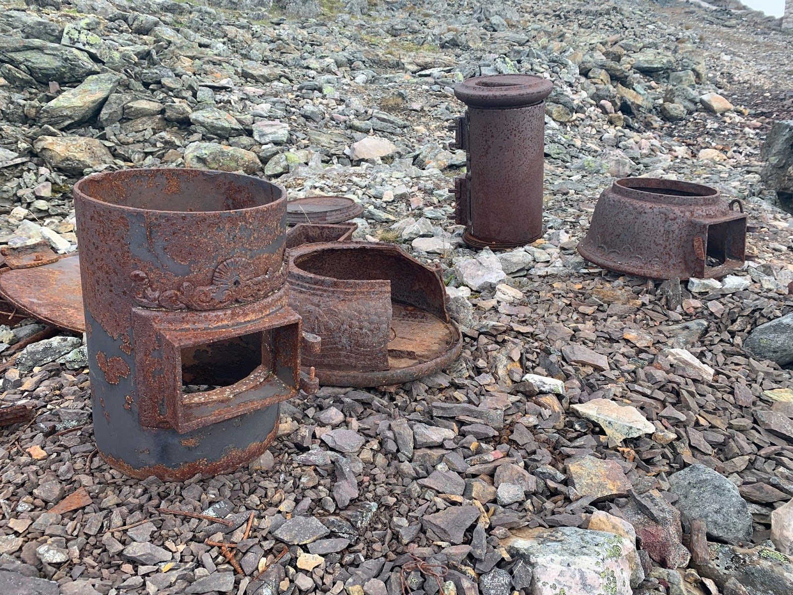
There are traces of the past everywhere at Haldde. The most shocking of these are the various ruins and artifacts that I assume are left over from the facility's destruction during World War II. Metal scraps and debris litter the landscape. During the hike up, every so often I would see tangled messes of rusted wire. I later learned that those were the remains of the electrical line that used to run from the nearest town up to Haldde. The Nazis systematically burned down every single electrical pole on their march to the observatory.
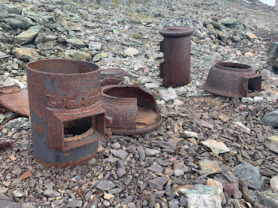 |
| old discarded wood stoves |
 |
| the remains of the "instrument building" |
 |
| unknown debris; scraps like this are all around the site at Haldde |
 |
| unlabeled historical artifacts on display in the hytte |
I was actually able to go inside the larger residence building because an "old time living" event was going on. Basically, school children from the area had been invited to hike up to Haldde and be hosted by volunteers wearing traditional early twentieth century Norwegian clothing and cooking traditional meals. It was fun to have some company, so I spent a good amount of time there having conversations and eating meals.
 |
| the old residence building - also restored in the 1980s |
 |
| the view from the observatory down to the residence building |
The wooden path you see connecting the residence and the observatory actually conceals an underground tunnel. The tunnel was constructed in the early 1900s as a way for researchers to get back and forth between the two buildings without going outside during the winter. The tunnel can still be accessed through an entrance in a small storage shed separate from the other buildings. I took one peak in and noticed that the walls were caving in. It was altogether a very creepy scene - debris scattered all over the floor and small shafts of light coming from unknown locations... I took a pass on any further exploration.
 |
| view from the residence up to the observatory; the underground tunnel is hidden underneath the wood path |
Overall, my stay at Nordlysobservatoriet Haldde was an amazing experience! Birkeland's research provided the foundation for our understanding of the northern lights today. It was very cool to stand on the same platform where he observed the phenomenon and made critical measurements. A new goal of mine is to one day see the northern lights for myself!
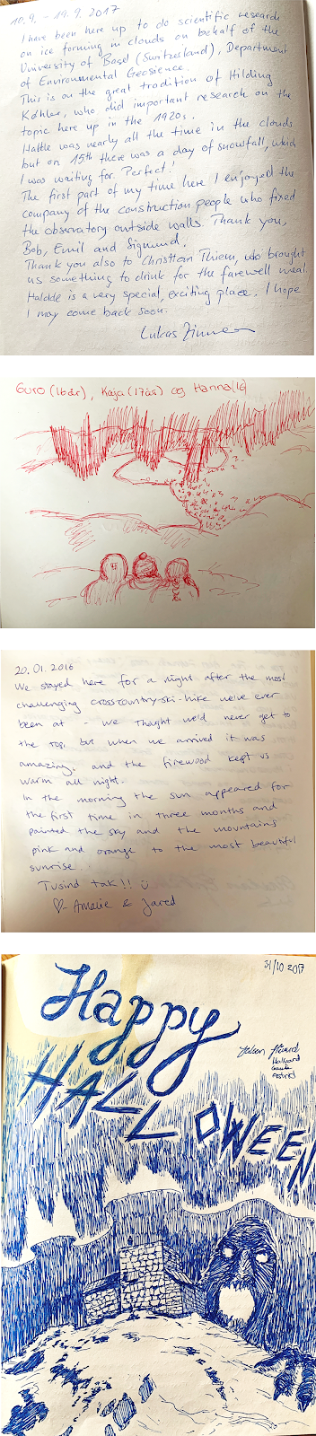
I will leave you with a few entries and sketches from the hyttebook, plus a sketch of my own!


Comments
Post a Comment